Boundary Trail #1 and Truman Trail
Mount Saint Helens
08/13/2006
8 Miles
Since the kids were in California, I had a rare weekend to myself and planned to go backpacking. But plans change. Myola just got a new job with the Department of Ecology, moved to Kelso, and needed some help painting the new house she and Josh bought, so she threw a "painting party." Jes told me how important it was to her to go, and I told her how much I was looking forward to hiking, so we compromised.
Saturday morning we made the drive to Kelso and began painting and drinking cheap beer. The walls had been brightly painted with primary colors, so we took on the task of taming them with white paint. After the day's painting, we sat around Myola and Josh's new fire pit, ate some awesome food, and were bit by mosquitoes. Myola, Josh, and their friends Erika, Bob, and baby Stuart sat around the campfire telling stories and drinking beer (Stuart especially). Jes and I set up my tent in the back yard, and enjoyed the stars through the mesh ceiling when we went to bed. Fire, bugs, tent, stars. Backyard camping wasn't too bad.
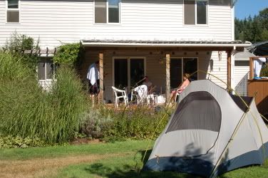
Camping at Myola and Josh's new house
At around 4:00, I awoke to the sound of water running. As I tried to figure out where the sound came from, we were hit suddenly by a blast of water, then another and another. Sprinklers! I ran out and tossed the rain fly on top of the tent. We laughed good-naturedly and tried to find the dry parts of our wet sleeping bags, but then another stream of water hit us from the front of the tent. A sprinkler had come on a couple of feet from us and was spraying water at full force against the unprotected door. Rain flies aren't meant for water at that angle and I said "we have to move!" I opened the front door, grabbed the fly, and threw it on top of the sprinkler like a good soldier diving on a grenade to protect his squad. We picked up the tent, carried it to the protection of the deck and tried to go back to sleep.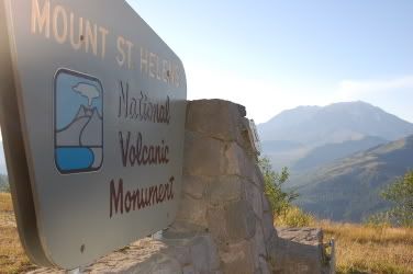
Welcome to Mt. St. Helens
The adventure of camping in a back yard was too much for me, so I decided to get up. I packed my pack and hit the road before 7:00. Jes let me use her Escape to drive to Mt. St. Helens for a quick hike. I didn't have a map (TOPO doesn't work unless you have a printer or carry a laptop with you), or a guidebook (I gave one to Myola and Josh as a present, though), and was hoping one of the visitor centers had some sort of hikes detailed or trail maps or something. Four official visitor centers welcome tourists on the 50-mile stretch of road known as SR 504. An additional one claimed to link the effects of the eruption to Jesus or religion or something. None of them open until 10 and none of them have outdoor bathrooms or garbage cans. I needed to use one of these, badly.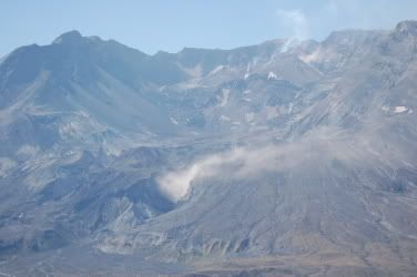
Steam eruptions from the lava dome and vent
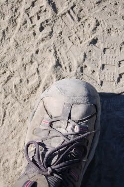
Finally I reached the Johnston Ridge Observatory, not having seen a single car on the road. Two cars were parked there and I saw two other people hanging around as I searched the grounds for a restroom or map. I decided to hike the Boundary Trail #1 after locating its location on a display. One other problem remained. My bladder. It would have to wait until I got a bit further from civilization. The cement trail turned into well-worn ash, and the number of footprints lessened the farther I walked from the parking lot. I still had to pee. I couldn't go in the woods, because there were no woods. A sign explained the proper Leave No Trace method of going 200 feet from a water source and off-trail, but another sign threatened me with a fine if I did. What to do? I found a mound to hide behind and tried to pee as far as I could off the trail while standing on the trail. I kicked some ash from the trail on top of it and went on my way.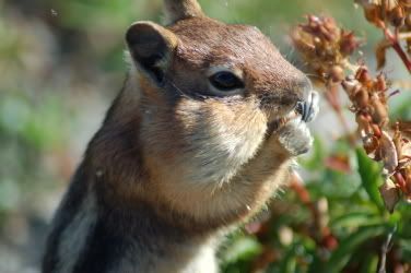
Western Mantled Ground Squirrel stuffing his face
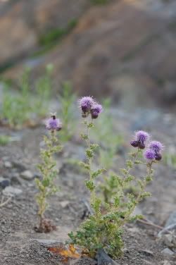
Three things were pretty constant: uninterrupted views of Mt. St. Helens, ash, and signs directing me to stay on the trail. The flora consisted mainly of Pearly Everlasting, two species of lupine, and Red Paintbrush. Gold-Mantled Ground Squirrels darted across the trail, as did the thousands of grasshoppers that warned as I approached. The little pests would click rapidly and throw their bodies in random places, sometimes under my shoes or against my legs.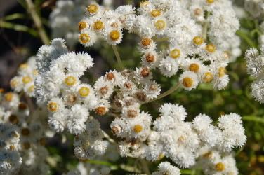
Pearly Everlasting
The crater of St. Helens steamed and the shape of her flanks suggested her massive former self. In the valley between the volcano and the ridge I was on, the pyroclastic flow and debris field suggested another planet. Deep valleys had been carved in the ash and mud in the 26 years since the eruption and formed hummocks. Everything was gray and foreign. The area is called the Pumice Plain.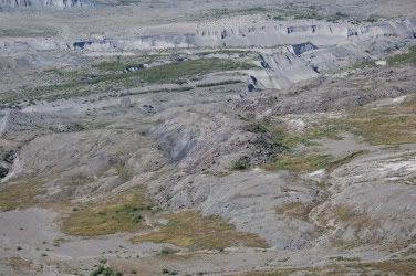
Pumice Plain
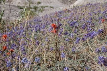
Common Paintbrush and Prarie Lupine
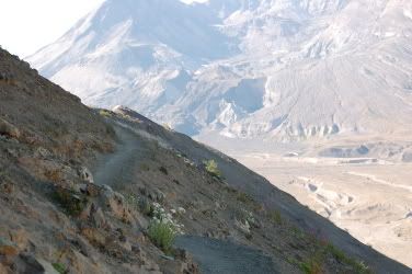
Exposed Trail
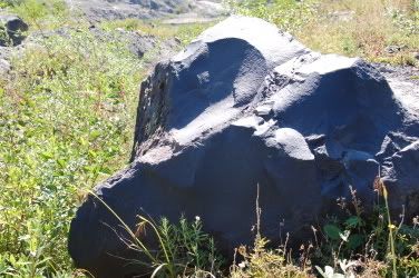
The photo that almost killed me. What are these?
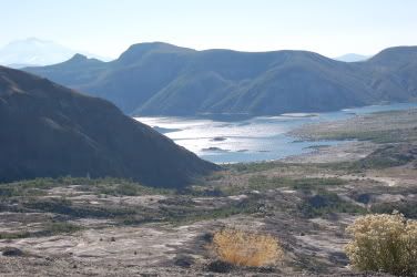
Spirit Lake
A trespasser from Mt. St. Helens
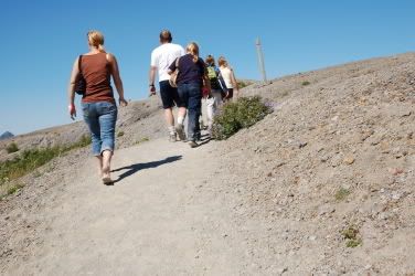
Dusty trail
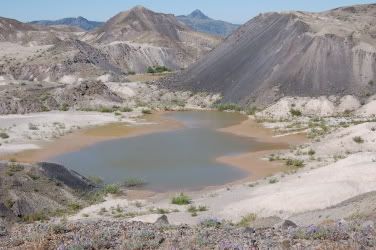
Ponds in valley floor
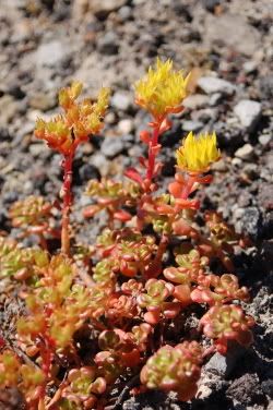
Oregon Stonecrop
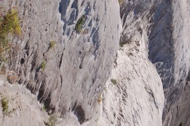
Ash canyons
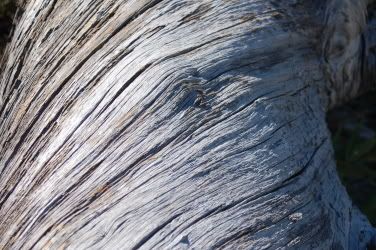
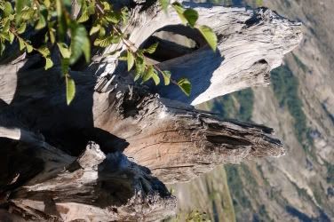
Twisted log on lee side of Johnston Ridge
One guy, complete with do rag, baggy jeans, and sideways hat was yelling at his girlfriend. They were arguing about who was going to ask me something. Damn! I didn't want to talk to them at all and hoped they wouldn’t bother me. As I rounded the switchback, the guy stared ahead, blocking the trail and I asked him to "excuse me" so I could pass. Perhaps he was intimidated by my huge, 5'6" stature, but he didn't say a word or make eye contact. He might have piddled a little though. His brash, loud girlfriend asked me the question they were arguing about: "Where does this path go?" To which I replied, "Well, you go around this ridge here, have some nice views of Spirit Lake and Mount Adams, and finally descend down to there." Then, get this. She asked me "Is there any food or drinks down there?" I didn't know if I should laugh or get pissed. I told her there wasn’t and she yelled at her kids to get back to the car.
Surreptitious photo of tourist seeking concessions in valley floor
The couple who had been lingering at the parking lot when I first arrived greeted me at the trailhead like we were old friends. I’d thought they were a couple of overweight obnoxious tourists, but they surprised me. Supposedly they’d gone to the Coldwater trailhead, found it too busy and filled with loud children, and decided on the Hummocks Trail, a 2.5 mile loop that came close to the Toutle River. They highly recommended it, calling it “an excellent example of rebirth” and spoke with an evident love of the wilderness.
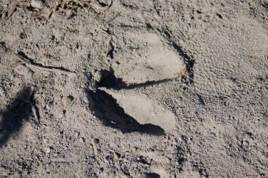
Elk tracks in ash
I got in line at the observatory, showed my Golden Eagle pass, and got a special pink wristband instead of the purple ones they handed out to the tourists. I stank, having not showered, and was completely covered in ash. I enjoyed the offended looks I received from the RVers and Californians as I nosed in close to see the exhibits. That finally lost its novelty and I left after a couple minutes.
The drive back was completely different from the drive up. Cars filled the lots at all the visitor centers and caused heavy traffic along the road. I left just in time. Just in time to finish some painting.
posted by Ted's Blog @ 4:25 PM
3 comments
![]()

3 Comments:
That is IT!! We're having a nature off.
Plus my picture is WAAAAY better. As evidenced by:
a) Multiple ass rock formations.
b) My ass.
It's on now, homey.
Man. This is like adopting an Asian kid: stale.
Sounds like I know the perfect location for a new concession stand! I'll make a fortune.
Post a Comment
<< Home