Tuesday, October 16, 2007

I'm Back!

I know it's been a long time since I posted here, but I figured this was my "outdoors blog" and haven't done much since last year. It will now be known as the "wherever the wind takes me" blog, since that is more my style.

A lot has happened this past year, mostly bad. My dad died in February and it has been a struggle ever since. Not a day goes by that I don't think about and miss him. I was lucky to have such a wonderful father, and am glad my kids got to know him, if only for a little while. I can't express in words how devastated I've been over this and wish for just one more conversation with him. I love you, Dad, and hope that I can live up to your example.

My grandmother, my dad's mother, died in June. She never could admit out loud that she'd lost her son, but must've needed to be with him. The Bullock side of the family is nearly gone now.

We all took a trip to Montana in July to spread Dad's ashes and attend a service for Grandma Julie. Perhaps when I get more comfortable with it, I will post photos from that trip.

Jes got out of the Coast Guard and began watchmaking school.

Scott started working on restoring a car. His blog is at http://scooterbullock.blogspot.com.

Callie has been working with horses and taking lessons. She too has a blog at http://callahanshorseblog.blogspot.com.

That's enough of an update for now.

Monday, August 14, 2006

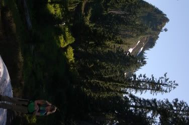
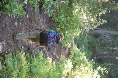
Boundary Trail #1 and Truman Trail
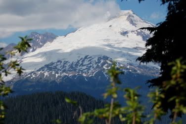
Mount Saint Helens
08/13/2006


8 Miles

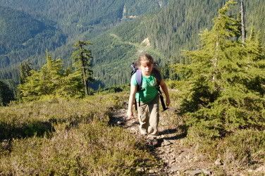
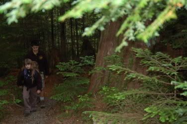
Since the kids were in California, I had a rare weekend to myself and planned to go backpacking. But plans change. Myola just got a new job with the Department of Ecology, moved to Kelso, and needed some help painting the new house she and Josh bought, so she threw a "painting party." Jes told me how important it was to her to go, and I told her how much I was looking forward to hiking, so we compromised.

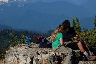
Saturday morning we made the drive to Kelso and began painting and drinking cheap beer. The walls had been brightly painted with primary colors, so we took on the task of taming them with white paint. After the day's painting, we sat around Myola and Josh's new fire pit, ate some awesome food, and were bit by mosquitoes. Myola, Josh, and their friends Erika, Bob, and baby Stuart sat around the campfire telling stories and drinking beer (Stuart especially). Jes and I set up my tent in the back yard, and enjoyed the stars through the mesh ceiling when we went to bed. Fire, bugs, tent, stars. Backyard camping wasn't too bad.

Photobucket - Video and Image Hosting

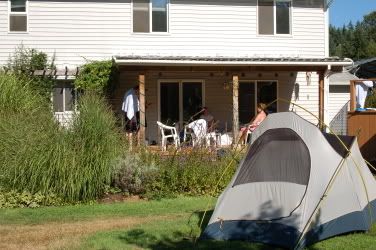
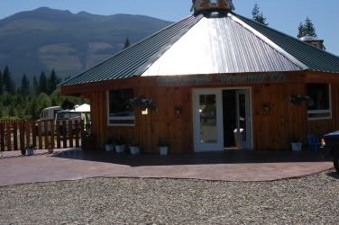
Camping at Myola and Josh's new house

At around 4:00, I awoke to the sound of water running. As I tried to figure out where the sound came from, we were hit suddenly by a blast of water, then another and another. Sprinklers! I ran out and tossed the rain fly on top of the tent. We laughed good-naturedly and tried to find the dry parts of our wet sleeping bags, but then another stream of water hit us from the front of the tent. A sprinkler had come on a couple of feet from us and was spraying water at full force against the unprotected door. Rain flies aren't meant for water at that angle and I said "we have to move!" I opened the front door, grabbed the fly, and threw it on top of the sprinkler like a good soldier diving on a grenade to protect his squad. We picked up the tent, carried it to the protection of the deck and tried to go back to sleep.

Photobucket - Video and Image Hosting

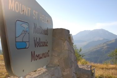
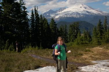
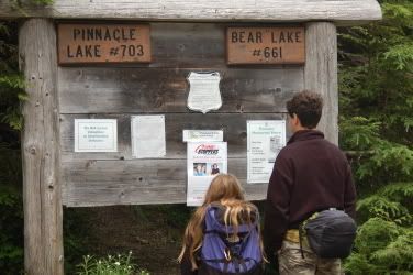
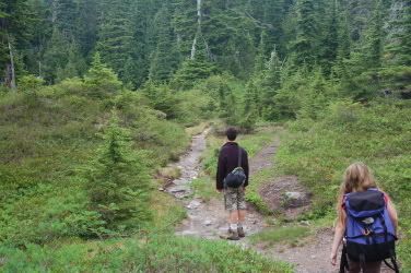
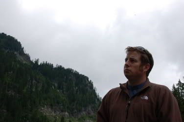
Welcome to Mt. St. Helens

The adventure of camping in a back yard was too much for me, so I decided to get up. I packed my pack and hit the road before 7:00. Jes let me use her Escape to drive to Mt. St. Helens for a quick hike. I didn't have a map (TOPO doesn't work unless you have a printer or carry a laptop with you), or a guidebook (I gave one to Myola and Josh as a present, though), and was hoping one of the visitor centers had some sort of hikes detailed or trail maps or something. Four official visitor centers welcome tourists on the 50-mile stretch of road known as SR 504. An additional one claimed to link the effects of the eruption to Jesus or religion or something. None of them open until 10 and none of them have outdoor bathrooms or garbage cans. I needed to use one of these, badly.

Photobucket - Video and Image Hosting

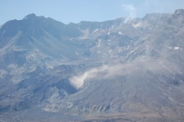
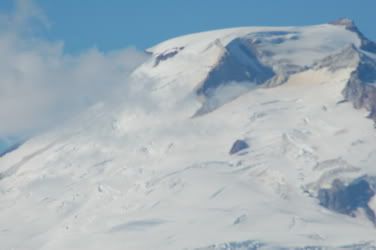
Steam eruptions from the lava dome and vent

Finally I reached the Johnston Ridge Observatory, not having seen a single car on the road. Two cars were parked there and I saw two other people hanging around as I searched the grounds for a restroom or map. I decided to hike the Boundary Trail #1 after locating its location on a display. One other problem remained. My bladder. It would have to wait until I got a bit further from civilization. The cement trail turned into well-worn ash, and the number of footprints lessened the farther I walked from the parking lot. I still had to pee. I couldn't go in the woods, because there were no woods. A sign explained the proper Leave No Trace method of going 200 feet from a water source and off-trail, but another sign threatened me with a fine if I did. What to do? I found a mound to hide behind and tried to pee as far as I could off the trail while standing on the trail. I kicked some ash from the trail on top of it and went on my way.

Photobucket - Video and Image Hosting

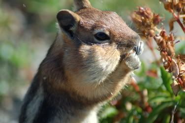
Western Mantled Ground Squirrel stuffing his face

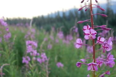
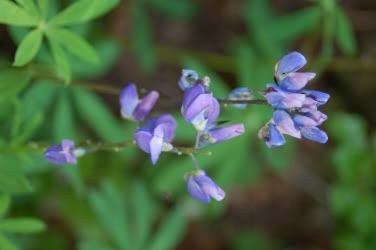
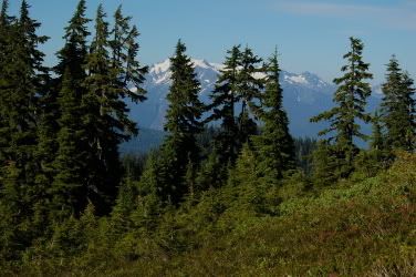
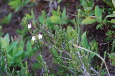
Three things were pretty constant: uninterrupted views of Mt. St. Helens, ash, and signs directing me to stay on the trail. The flora consisted mainly of Pearly Everlasting, two species of lupine, and Red Paintbrush. Gold-Mantled Ground Squirrels darted across the trail, as did the thousands of grasshoppers that warned as I approached. The little pests would click rapidly and throw their bodies in random places, sometimes under my shoes or against my legs.
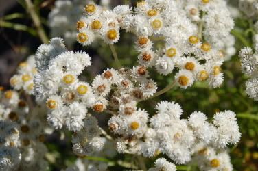
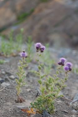
Photobucket - Video and Image Hosting

Pearly Everlasting

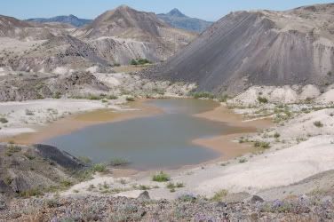
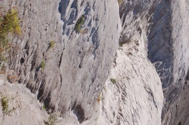
The crater of St. Helens steamed and the shape of her flanks suggested her massive former self. In the valley between the volcano and the ridge I was on, the pyroclastic flow and debris field suggested another planet. Deep valleys had been carved in the ash and mud in the 26 years since the eruption and formed hummocks. Everything was gray and foreign. The area is called the Pumice Plain.
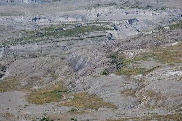
Photobucket - Video and Image Hosting

Pumice Plain

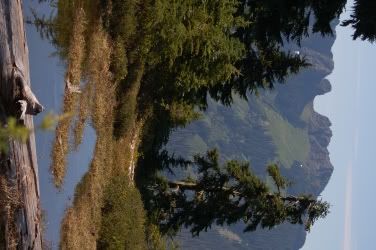
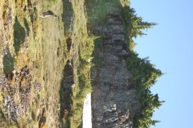
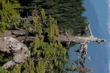
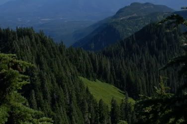
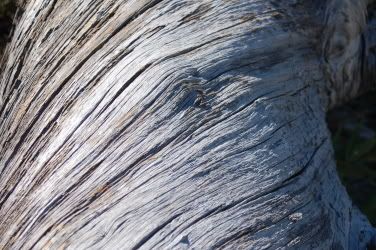
In the few instances where the trail passed onto the lee side of the ridge, isolated blow downs and twisted wood showed evidence of the forests that had been destroyed in the blast. Small alders and a couple of baby Douglas Firs, Pacific Silver Firs, and Hemlocks tried to take hold on the sterilized hillside. Only small alpine wildflowers proliferated.

Photobucket - Video and Image Hosting

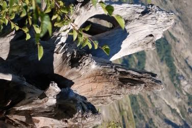
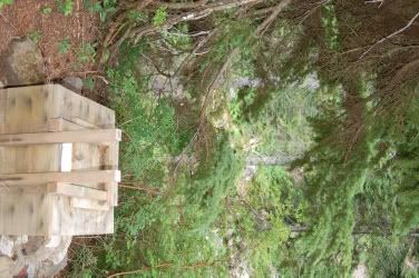
Stump and Sitka Alder

Photobucket - Video and Image Hosting

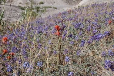
Common Paintbrush and Prarie Lupine

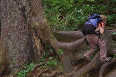
The trail cut into the steep mountainside on one portion was narrow and dropped off hundreds of vertical feet. I spied fireweed new plant. As I bent down to photograph this plant for identification, my pack hit the face above and uphill from me, causing me to fall a bit toward the abyss. I pondered falling face-first down the hill and wondered if my camera would be a sufficient replacement for an ice axe for self-arrest.
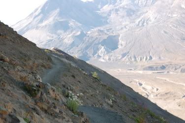
Photobucket - Video and Image Hosting

Exposed Trail

Photobucket - Video and Image Hosting

The photo that almost killed me. What are these?

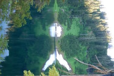
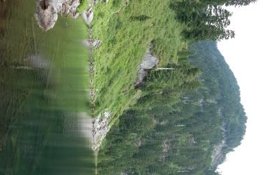
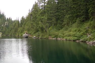
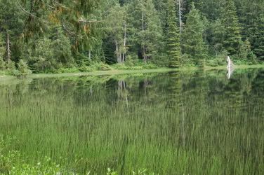
I rounded the western flank and Spirit Lake came into view. Now that was my new destination. I'd heard all about Mount Saint Helens, the Toutle River, and Spirit Lake ever since the eruption, and knew I wanted to see it close-up. With no trees to break them up, the morning winds rippled the water and the water shot back the reflection of the sun in little stars jumping around on its surface. The trail seemed to be heading in that direction and it seemed like a natural terminus.
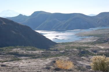
Photobucket - Video and Image Hosting

Spirit Lake

Finally, a fork in the trail. Descending into the valley, I followed the Truman Trail, named after the famous stubborn old man who wouldn't leave when the mountain threatened his home and his life. Plants began to bloom, even crowding the trails in places. As I bent down to study the elk tracks and scat, a couple of White-Crowned Sparrows played in the bushes. Small creeks did their part in restoring life to the desolation, cutting into the mounds of ash and providing life to alders and other plants. The ravens, like the grasshoppers, announced my visit, and small animals in the brush ran and hid when I'd inadvertently approached them too closely. The variance in life from here to the exposed ridge was pronounced.

Photobucket - Video and Image Hosting

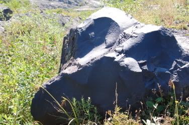
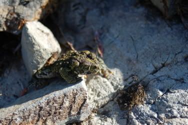
A trespasser from Mt. St. Helens

Photobucket - Video and Image Hosting

Dusty trail

Now I hiked north, straight toward the mountain. I climbed up and down over canyons of ash. My shoes kicked the white dust into the air, into my face, and into my hair. Problem was, I wasn't going toward Spirit Lake at all. In fact, I started hiking away from it as I passed some little ponds. I kept hiking east and north, but gave up when I realized the trail I was on was just heading back toward the observatory in a loop. I turned around and headed back the way I came.

Photobucket - Video and Image Hosting

Ponds in valley floor

A large "CRACK" sounded as I neared the junction with the Boundary Trail. Rocks dropped from the ridge and fell to the valley floor, knocking down more rocks on the way. It was probably loosened by the 3.1 earthquake earlier that morning.
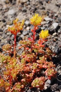
Photobucket - Video and Image Hosting

Oregon Stonecrop

I only had 16 ounces of water with me, having not found a water spigot at the visitor center, and was exerting myself quite heavily. My filter was safe at home, and I didn’t want to drink right from the stream. Climbing in elevation and walking in the soft ash and sand were taking their toll. Usually when I hike by myself, I push harder than when I'm with my kids, and had to remind myself to slow down a bit. The hot sun was burning my neck and face, and I hadn't eaten anything.

Photobucket - Video and Image Hosting

Ash canyons

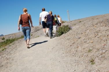
After 10:30, I heard my first sign of "technological progress" of the whole morning. A helicopter flew above the crater, making it available to those who don't deserve to see it, but have big wallets. In my book, you should have to hike your way in to get that close. Damn cheaters and weaklings. Where's Darwin anymore? Then, shortly after, I saw the first "hikers" of the day. A family of four was turning around about a mile from the trailhead. They wore purple wristbands and visors and carried souvenirs. As I hiked back, their clones lined the trail like a shopping mall on the day after Thanksgiving. Tennis shoes, flip-flops, cameras, and walking sticks. IPods, Hawaiian shirts, ice cream, and a lack of etiquette. They dropped Goldfish crackers and M&Ms on the trail, and walked in herds. One guy, supposedly the "outdoorsman" of his little group, was trying to impress the women he was with by explaining that they would have to hike back up the hill they just came down. I needed out, and fast.

Photobucket - Video and Image Hosting

Twisted log on lee side of Johnston Ridge

One guy, complete with do rag, baggy jeans, and sideways hat was yelling at his girlfriend. They were arguing about who was going to ask me something. Damn! I didn't want to talk to them at all and hoped they wouldn’t bother me. As I rounded the switchback, the guy stared ahead, blocking the trail and I asked him to "excuse me" so I could pass. Perhaps he was intimidated by my huge, 5'6" stature, but he didn't say a word or make eye contact. He might have piddled a little though. His brash, loud girlfriend asked me the question they were arguing about: "Where does this path go?" To which I replied, "Well, you go around this ridge here, have some nice views of Spirit Lake and Mount Adams, and finally descend down to there." Then, get this. She asked me "Is there any food or drinks down there?" I didn't know if I should laugh or get pissed. I told her there wasn’t and she yelled at her kids to get back to the car.

Photobucket - Video and Image Hosting

Surreptitious photo of tourist seeking concessions in valley floor

The couple who had been lingering at the parking lot when I first arrived greeted me at the trailhead like we were old friends. I’d thought they were a couple of overweight obnoxious tourists, but they surprised me. Supposedly they’d gone to the Coldwater trailhead, found it too busy and filled with loud children, and decided on the Hummocks Trail, a 2.5 mile loop that came close to the Toutle River. They highly recommended it, calling it “an excellent example of rebirth” and spoke with an evident love of the wilderness.
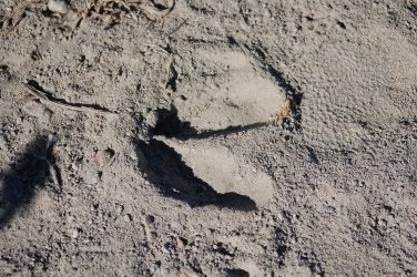
Photobucket - Video and Image Hosting

Elk tracks in ash

I got in line at the observatory, showed my Golden Eagle pass, and got a special pink wristband instead of the purple ones they handed out to the tourists. I stank, having not showered, and was completely covered in ash. I enjoyed the offended looks I received from the RVers and Californians as I nosed in close to see the exhibits. That finally lost its novelty and I left after a couple minutes.

The drive back was completely different from the drive up. Cars filled the lots at all the visitor centers and caused heavy traffic along the road. I left just in time. Just in time to finish some painting.

Sunday, August 06, 2006

Dock Butte and Blue Lake
08/05/2006


4.5 Miles
1500 Feet Elevation Gain

We got a late start this morning, leaving the house after noon. Callie and Scott were both tired (Scott was up until 5 am reading) and it made for a quiet drive until we almost got into an accident north of Marysville. Three cars just in front of us slammed into each other. I swerved out of the way and avoided it, but my hands and legs shook from the scare.

Our intent this weekend was to take a short hike and soak in the Baker Hot Springs to relax afterward. I stopped off at the ranger station in Sedro Woolley to gather current trail and road conditions where I ran into Dermot, my ex-coach from my hurling team. He said he was camping for the first time. Now, he’s in charge of some committee for the Sierra Club and Scott asked why it would be his first time camping. Maybe it was his first trip of the year. Gotta give the Sierra Clubbers the benefit of the doubt.

Photobucket - Video and Image Hosting

Birdsview Brewing Company


Along SR 20, I wanted to stop at the Eagle Haven Winery, having fallen in love with their Madeleine Angevine and Siegerrebe, but I resisted in the interest of expediency. Unfortunately, I noticed that the Birdsview Brewing Company had recently opened and wasn’t able to restrain myself. I stopped in and bought a 64 ounce “growler” of their amber ale, which I am enjoying at the time of this writing. I highly recommend anyone that is in the area to try it.

We took the Baker Lake Road from SR 20 and headed north for about 12 miles before taking a left on the well-maintained Forest Service Road 12. 12 branched into 13, and finally into 1230. 1230 was a much different story. My Dodge pickup, despite its new tires, was having a tough time holding traction on the washboard road up the switchbacks. Callie was nervous, but I took my time and enjoyed the Fireweed that lined the road (from my peripheral vision of course).

Photobucket - Video and Image Hosting

Fireweed

Finally, about 9 miles from Baker Lake Road, we reached the trailhead. Only a couple other cars were parked there and we all stepped out into a barrage of biting black flies. They covered my exposed legs immediately and felt like I ran into a patch of nettles. The only thing that kept them away was to keep moving, so I used that as a motivator for the kids to head out.

Photobucket - Video and Image Hosting

Five-Stamened Mitrewort?

The trail dropped at first, surprising Callie who pointed out that almost every hike we go on is headed immediately uphill. She wasn't wrong, though, because shortly after registering, we headed upward. Up and up and up. Upon reaching the first vista, Callie and Scott gladly took a break to allow me to take some more photos, but the flies persisted and we had to keep moving. The image of Mount Baker filled most of the horizon, but the kids hadn’t noticed since they were just staring at the trail in front of them. It was a nice, warm day, and I enjoyed the exertion. Callie and Scott didn’t and started arguing about who got to be in front, how fast we should go, and other silly stuff, so I let Scott take off ahead on his own. He likes to feel like a big boy. Hey, why is it that when you call someone a “big boy,” they always take it to mean the opposite?

Photobucket - Video and Image Hosting

A break...but not from the flies

Callie was tired and thirsty, but didn’t want a drink of water. Poor thing, she didn’t seem to be having the best time. I felt guilty for it, but if the kids had their way, they might never leave the house or have any sort of exercise. They always really enjoy the experience (the destination, not the journey) and love to talk about it afterward, and this time, it was much the same.

Photobucket - Video and Image Hosting

"We're not going up that, are we Daddy?"

Finally, we reached some meadows and spotted a large rock formation (butte) ahead. “We’re not going up that, are we daddy?” Callie asked. “Not sure,” I said, but I thought we probably were. She whined a little, but upon seeing the first patch of snow, her attitude completely changed. She ran uphill, now demonstrating that she wasn’t as tired as she’d led me to believe, and stomped in the little piles of snow. She grabbed a handful of it and pressed it to her forehead until it went numb. Then she tried it on her chin, and it went numb too. We hiked up a higher grade than before, but she was distracted by the joys of snow and didn’t seem to notice. Every once in a while, I would get a face full of snow when she tossed it up behind her, but she was happy and it didn’t bother me. Now, she enjoyed the tarns, the snow, the flowers, and commented on the erosion caused by a road carved into Mount Baker. Now that’s my girl

Photobucket - Video and Image Hosting

Snow...

Photobucket - Video and Image Hosting
... in August!

Views of Loomis Mountain, Twin Sisters, and Mounts Baker and Shuksan were incredible and huge. Luckily, I didn’t trip when my eyes were fixed upward. When they weren’t pointing up, they were pointing down at the White Mountain Heather, Lupine, and other wonderful alpine plants that were making their summer appearance.

Photobucket - Video and Image Hosting

Arctic Lupine

A couple from Vancouver passed us up. They weren’t breathing hard or sweating, and the woman was much too pretty to be hiking in the mountains. Actually, there are quite a few beautiful women on the trails. More so than most places. Scott even made an observation to that effect. While hiking up the talus slope on the final climb to the top, the pretty couple passed us on their way back down again too. “It’s totally worth it,” they said.

Photobucket - Video and Image Hosting

Loomis Mountain and tarn

Photobucket - Video and Image Hosting

Beautiful Mount Baker

Photobucket - Video and Image Hosting

Mount Shuksan behind the trees

A family came running down the slope just before we hit the top, followed by their dog (unleashed, of course). They had never heard of yielding to those climbing uphill, and it was too bad that they didn’t run a little faster and farther.

Photobucket - Video and Image Hosting

White Mountain Heather

We made one last, scary maneuver of climbing up a tree root and a banked rock with a few-hundred foot drop behind us and reached the summit. Scott and Callie both had huge smiles and a beaming sense of accomplishment. Scott pointed out the USGS survey marker to Callie and they were so proud of themselves. Scott even gave Callie one of his Cliff Bars. We hung out, ate, looked at the beautiful, 360 degree views, and inspected the last remnants of the lookout that was burned down. I tried lying down to take a photo, but glass shards were everywhere. If you’ve packed a beverage all the way up here and drank it, why can’t you pack it down? It’s lighter, and gravity helps you the whole way! Inconsiderate a-holes.

Photobucket - Video and Image Hosting

Scott on the last part of the climb


Photobucket - Video and Image Hosting

Callie making the final approach

Photobucket - Video and Image Hosting

Dammit, is this a krummholz?

Photobucket - Video and Image Hosting

Callie's first summit!

Photobucket - Video and Image Hosting

USGS Reference Mark on Dock Butte

We had complete solitude all the way back. Callie, of course, picked up some more snow and a couple of little rocks. She likes to pick up rocks on every hike we go on, despite Forest Service regs and Leave No Trace tactics. Thoreau did it, so it can’t be too bad, plus, these places probably won’t exist in the same form they are today when she gets older.

Photobucket - Video and Image Hosting

Scott trading Callie a Cliff Bar for future favors

Photobucket - Video and Image Hosting

The summit of Mount Baker

Photobucket - Video and Image Hosting

Meadows on hill south of Dock Butte

Photobucket - Video and Image Hosting

Juvenille Western Toad

Scott took off again, this time without waiting for us at regular intervals. Upon reaching the fork in the trail that headed toward Blue Lake, he wasn’t there and I figured that he'd headed all the way back to the truck. I tightened up my shoulder straps on my pack and ran back to the trailhead. Scott was there feeding Gray Jays (I told him he shouldn’t be doing that and threw a little crumb to them when he wasn’t looking). He put his pack back on and we ran back to the fork. Callie’s feet were starting to blister and I told her we could just turn in, but she wanted to keep pressing on to see the lake. We were so close after all. We’d seen Blue Lake from the trail to Dock Butte, and it looked worth the extra mile-and-a-half. The flora started changing as we neared the lake, and some large, gray chunks of fur sat in the middle of the trail. I wonder what battle took place here.

Photobucket - Video and Image Hosting

Blue Lake from Dock Butte trail

Scott, again, went ahead and said “here it is!” Callie ran ahead and I followed. With the light, glacial flour, and deepness of the lake shone a wonderful, artificial aqua-turquoise blue. The cliff overhead reflected perfectly in the lake in the calm afternoon and protected the snow patches on the steep bank. Fish rose to eat their dinner, and some jumped all the way out of the water for the bouncing insects. As the kids filtered some water, we heard a “woo hoo!” from across the water. I investigated and a woman was camping out on a little peninsula. We left her alone and hiked back toward the truck.

Photobucket - Video and Image Hosting

Hiking to Blue Lake with blisters

By the time we got to the trailhead, it was after 7:00 and too late to go to Baker Hot Springs. I'd neglected to bring my headlamp, and Callie and Scott were pooped. We thought it would be safer to just declare the day over and go home.

The drive back down was even more nerve-racking for Callie. Wary of the steep drop-offs, the glare on the windshield made me slow down and have to look out the side window to see where we were going. I stopped to identify some Goat’s Beard and I told Scott about the “leaves of three” guideline about poisonous plants as I handed him a specimen of it. He stopped to notice the 3 times compound leaves and threw it to the ground. Sick humor.

We got home after nine and lined up for the showers. I love taking a shower and being able to see the dirt that washed off of me!


Photobucket - Video and Image Hosting

Blue Lake, how apropos!

Monday, July 31, 2006

Pinnacle Lake
07/29/2006

4 Miles round Trip
1100 Feet Elevation Gain

Photobucket - Video and Image Hosting

Pinnacle Lake Trailhead

Backpacking, Hiking, Camping, or the REI garage sale?

Well, due to the lack of tent space and weather forcast for Sunday, Callie and I went to the REI Alderwood garage sale. I picked up a couple pairs of pants and a filter for Callie. The filter is pretty cool. You just fill the bottle, and the water is filtered as you suck it out of the straw. She was really excited about it, so I used it as a motivator to get her to go for a hike. "Do you want to USE it now?"

We got home and dragged Scott out of bed around noon, packed up, and headed toward Verlot to hike to Independence and North Lake.

As per the recent news articles about the murders of Mary Cooper and Susanna Stodden on the Pinnacle Lake trail, it was recommended that hikers check in at the ranger station before hiking along the Mountain Loop Highway since the killer was still on the loose. We stopped, discussed the conditions with the ranger, and decided to head to Pinnacle Lake instead. The kids weren't scared and I didn't want to let some criminal tell me where we can and can't hike. I wanted to take back that damn trail.

Photobucket - Video and Image Hosting

Sign at the trailhead

The trailhead wasn't completely deserted. Two other cars were parked there, the only two cars I saw the whole way up. A Crime Stoppers poster adorned the sign at the trailhead. It was completely out of place, and I wanted to tear it up, but thought the good that it could bring was more important than my anger. The crime scene tape along the road didn't please me either.

Photobucket - Video and Image Hosting

Huge hemlocks and cedars line the trail

Regardless, we strapped our packs to our backs and headed up the trail, wary of our surroundings. Both kids hiked close by me, not because they wanted to, but because I insisted.Gradually climbing, the trail is quite rocky, blocked by roots, and narrow. Just the way we liked it. Huge trees of various species watched over us, and the salmonberries provided a nice treat. A short portion of the trail is devoid of undergrowth, but that is passed quickly, and the life sprouts up again.

Photobucket - Video and Image Hosting

Mmmm, salmonberries!

What a beautiful hike, and one that I can't believe I've overlooked for all these years. It wasn't in my "Best Hikes for Childeren" books, my hiking bible for trips with my kids for the past couple of years.

Photobucket - Video and Image Hosting

The trail is quite muddy in places

At one of the switchbacks, we met the first hikers we'd seen that day. They were coming down and promised that is "sure is pretty from the top." At one of the switchbacks, the trail seems to continue forward, and we spend a good few minutes bushwacking until Callie remembered that she saw the real trail back where we came from. She got a new nickname for that. "Pathfinder." She said she already had enough "forest names" and I asked her to choose her favorite. She told me that you can't choose your own. So, "Pathfinder" it is until I think of another.

Photobucket - Video and Image Hosting

"Pathfinder" climbing up the trail

Callie had to really climb over some of the blowdowns, but had fun doing it. Scott just trudged along, not saying much. They were getting really tired, and I promised them that we were close. I saw the top of a ridge, and assumed the lake to be on the other side. A tiny lake was there, but not big enough as I derived from my map. They really wished it was, though. We crossed the only other hiker we saw that day. A gentleman who couldn't hear what I was saying came around the corner and said we were about fifteen minutes away. I looked at the kids and they wanted to press on.

Photobucket - Video and Image Hosting

"Butt" rock

The trees open up to a sub-alpine meadow filled with heather, glacier-polished rocks, and krummholz. I'm not positive they were, but wanted to say "krummholz." Both kids were excited and almost began running when they saw a small, grassy tarn. Again, I thought the real Pinnacle Lake was farther on. They didn't seem to need or want any more than "Pinnacle Pond," as they called it, but kept going in fear of my consequences.

Photobucket - Video and Image Hosting

Sitka Mountain Ash

Photobucket - Video and Image Hosting

Pink Mountain Heather

At last, Pinnacle Lake came into view. The bugs did too. Callie claimed one large, flat rock, and Scott claimed another. Mount Pilchuck's shoulder stood at the southwest side of the lake. My DEET was distributed (actually traded for food from Scott, and a sip from the new filter from Callie) and applied. It worked amazingly well, as the cloud of bugs lifted. They still hovered near our faces, but didn't actually land or bite. And the DEET gave an interesting flavor to the peanut butter Clif Bar Scott gave me.

Photobucket - Video and Image Hosting

Almost there

Photobucket - Video and Image Hosting

Pinnacle Lake

Photobucket - Video and Image Hosting

Pinnacle Lake shore

Scott sat and ate and pondered the beauty, while Callie filled her water bottle. I checked out the small pond at the outlet. We realized we only had about forty-five minutes until we had to leave as to get back before dark. Our plans for swimming changed when we felt the water and saw that it was lined with submarine logs and a huge drop-off. Since I've become quite a connoisseur, I checked out the backcountry toilet. I didn't get a chance to use it though.

Photobucket - Video and Image Hosting

Backcountry Toilet

Photobucket - Video and Image Hosting

Outlet of Pinnacle Lake

The time flew by and we had to head back. We all were sorry we had to leave such a beautiful place. I think Pinnacle is my new favorite lake.I don't think that I took any of the beauty for granted that day. It really pissed me off that it was ruined for Mary and Susanne and all the other hikers who are now afraid. Don't get me wrong, I was a little scared too. The more I thought about it, the madder I got. It's like a murder in a church. I was constantly looking around, worried that my wonderful day could be ruined. Worried that my kids might not be able to tell their kids about this day. Seeing all the flagging tape along the trail and just imagining what it could be marking.

Photobucket - Video and Image Hosting

Callie at the lake

Photobucket - Video and Image Hosting

Scott really is happy to be here

All of the sudden, a foreign sound comes from behind me. I spin around. My first aid kit had found its way out of my pack and I reach down to pick it up. As I put it back in my pack, I realize my maps are missing. And my camera filter. And my hat and towel. Probably $100 worth of stuff. Upset by the fact that I was startled...that I had any reason to be startled, and the loss of my gear without time to retrieve it, I ranted a bit and cut my losses. I didn't want to leave the kids alone to run up to find it (it could be over a mile away), and didn't have time to take them back up with me. My headlights on my truck had just gone out, and I needed to be home by dark. Callie started crying, since she tries to take responsibility for everyone's problems.

Photobucket - Video and Image Hosting

Rare photo of me

We did have just enough time to check out Bear Lake for a minute. The shore was grassy, but campsites were available. I'll file that away for future reference. Although the weather was overcast, I'd lost my stuff, we were hiking where two wonderful women were killed while enjoying nature's beauty, and Callie's knee hurt, I am so thankful that we were able to do our small part to take back that trail.

Photobucket - Video and Image Hosting

Bear Lake